
Yuba City - California Gold Mining Photographs - 1920
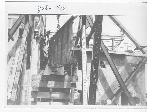
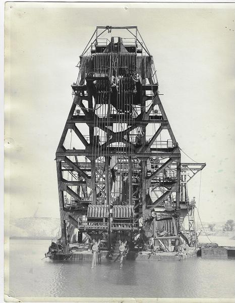
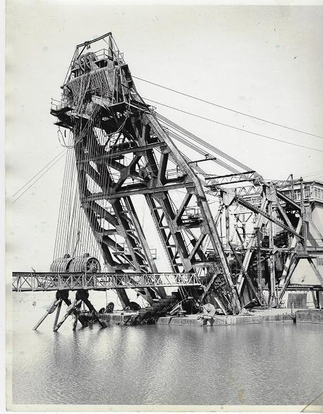
Yuba City area gold mining. 32 photographs ( 5" x 7" and five measuring 8" x 10") depicting the large industrial gold dredges that mined the Yuba River in California. The images here depict five different dredges, from various angles and construction that were active around 1920 and were identified as #12, #14, #17, #20 and #21. The photos all have great contrast.
"In 1893, the California Debris Commission began to dredge the Yuba River near Marysville to mitigate the environmental damage from hydraulic mining, and piled the gravel along the river's banks. Later, in 1904, W.B. Hammon introduced the first bucket-line gold dredge to the area, and before the end of 1904, two such gold dredges were operating. This Hammonton dredge field rapidly became one of the most active dredge fields in the state, with 14 gold dredges operating by 1908.[1] Dredging to clear the active channel of the Yuba River was done periodically, but a vast majority of dredging was done away from the active channel, with the purpose of recovering gold from the river sediments. This off-channel gold dredging accounts for the vast majority of land dredged, and is what created the linear gravel piles, called tailing windrows, now visible in aerial photos. And while historic upstream hydraulic mining did result in the deposition of 10 to 40 feet of hydraulic mining debris (slickens) in the area of the Hammonton dredge field,these slickens were considered uneconomical at the time (because they had already been processed for gold once), and the primary target of gold dredging was the native river sediments (alluvium) of the Yuba River. To that point, a vast majority of the more than one billion cubic yards of material dredged was native alluvium, not hydraulic mining debris. This dredge field is the largest in the state, both in terms of volume of material dredged, and amount of gold recovered (5.14 million ounces, estimated). The dredgers also created over 200 ponds, which are fed by a network of underground rivers, which in turn were formed due to the porosity of the ground. The water in these ponds is usually clear blue, the impurities having been filtered by the gravel. The Debris Commission also built both the Englebright Dam to the east and the Daguerre Point Dam west of the goldfields to trap debris caused by hydraulic mining.
In the twentieth century, a series of mining companies reprocessed the tailings, extracting gold that was increasingly difficult to separate from the gravel. Even though the ore had already been processed, it was the principal source of gold in California for some time. Two mining towns, Hammonton and Marigold, were founded to house the gold miners and their families, but have been largely abandoned since 1957.[4] By the 1970s, it was economically impossible to retrieve any more gold, and the debris became a source of aggregate, an essential ingredient of concrete. It has been estimated that up to $15 billion worth of aggregate lies within the goldfields, although the mining industry disputes this figure." (Wikipedia)