

Appleton's Railway Map of the United States and Canada - 1871
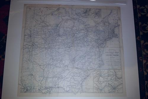
D. Appleton and Co. D. Appleton and Co. 1871. 29 x 26 inches. 2nd ed. with the first being in 1869. The railway map goes from the east coast into the eastern Dakotas, Nebraska, Indian Territory, and eastern Texas. Insert maps of the cities of New York, Philadelphia, Boston, St. Louis, Cincinnati, Chicago and Baltimore. The verso contains advertisements for various services and other Appleton publications. Also a map titled MAP OF THE MISSOURI, KANSAS AND TEXAS RAILWAY WITH CONNECTIONS. Not in Rumsey with OCLC locating only three copies. A scarce map in vg cond.
Price: $ 1,250.00
Item #: 1332
Author: D. Appleton and Co.
Publisher: D. Appleton and Co.
Edition: 2nd ed. with the first being in 1869
Pub. Year: 1871
Condition: vg
Rarity: very scarce