
OFFICIAL AUTOMOBILE HIGHWAY AND ROUTE MAP OF TEXAS, S.W. ARKANSAS, S. OKLAHOMA AND E. NEW MEXICO
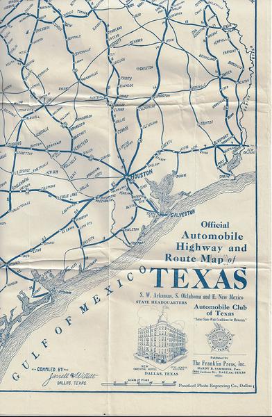
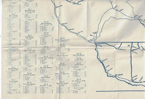
OFFICIAL AUTOMOBILE HIGHWAY AND ROUTE MAP OF TEXAS, S.W. ARKANSAS, S. OKLAHOMA AND E. NEW MEXICO. Automobile Club of Texas. Compiled by Jarrell and Willett - Dallas, Texas. Pub. by The Franklin Press, Inc. Practical Photo Engraving Co., Dallas. 32 x 39/5 inches. Large sheet map with roads indicated in blue. Among the higways listed are the Bankhead Highway from Dallas to El Paso; the King of Trails from Dallas to Brownsville; The Colorado to Gulf from Fort Worth to Colorado Springs; The Meridan Highway from Fort Worth to Laredo; The Dixie Overland from Dallas West; the Denver, Canadian and Dallas Route from Dallas to Denver plus the Old Spanish Trail, The Exall Highway; The Pugit Sound to Gulf Highway; the Del Rio to Canadian; The North Texas Highway; The Jefferson Highway; The F.F.F.; the C.K.C. & G. Highway, etc. In total 28 different highways are shown on the map with cities and distances indicated along the way between highway destinations. There are several small chips in the folds along with several fold tears, but overall in vg cond. Unrecorded.